Hi, I'm Vimlesh Kumar. This is my channel about computer, website , educational and technical tips that you can use to grow your knowledge & learn more for do more.
Photo Realistic 3D map of Mount Everest
3D Reality Maps will use the data, captured on an ongoing basis by Digital Globe's fleet of earth imaging satellites and processed to three- dimensional data by DLR, to create high-definition 3D maps of large-scale natural landmarks and other major tourist destinations worldwide. The maps are accessed and navigated using the company's intuitive and easy-to-use 3D navigation software, available for free download at its website.
"This is a perfect example of the new and innovative ways our customers are using Digital Globe imaging and insight to solve real-world challenges, deliver value to their customers, and fuel growth, "said John Oechsle, executive vice president of strategy and product at Digital Globe. "Our relationship with DLR and 3D Reality Maps shows that no matter how big the goal, Digital Globe can help you reach it."
As a first demonstration of their leading-edge combined capabilities, the joint group created one of the most detailed and accurate 3D maps of Mt. Everest and the surrounding Himalayan mountain region ever achieved. To experience it, visit the 3D Everest website at www.everest3D.de.
It is now being used by support personnel to track a 12-climber expedition, sponsored by climbing enthusiast and expedition management company Peak Freaks. The climbers set out to summit Mt. Everest in late March. The climbers are expected to reach the top of the world's tallest mountain, standing at 8,848 meters or 29,000 feet above sea level, sometime in the next 10 to 15 days. For more on Peak Freaks, visit www.peakfreaks.com.
"Most current 3D models of Mount Everest are created at a lower resolution, which makes rock faces blurred and coloring unnatural, "explained 3D Reality Maps CEO Dr. Florian Siegert. "With a ground resolution of the 3D data of 150 cm, our application is about 400 times better than that available in most 3D views of the mountain. This is truly a breakthrough in satellite imagery-based 3D modeling and real time 3D rendering."
To achieve this level of accuracy, DLR experts used a new methodology for 3D stereo (aerial) image processing, which was originally developed for international space program ‘Mars Express'. It was further refined at the DLR Center for Robotics and Mechatronics RMC in Oberpfaffenhofen and Berlin, and can now be applied to high resolution satellite images.
The extreme level of detail achieved in 3D Everest gives crews supporting the climb capabilities never before possible. Personnel, camped miles away, can now pinpoint the climbers' location on the virtual version of the mountain and monitor their progress in real-time. For mountaineering enthusiasts, media partner Elevation Outdoors will be posting real-time content from the climbers' journey on their landing page "Climbing Everest."To learn more visit http://www.elevationoutdoors.com/category/climbing-everest/.
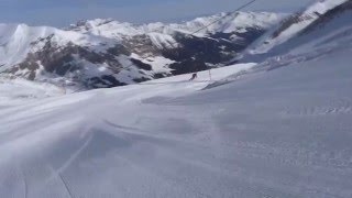
3D reality Maps' customers include many of the largest ski areas and tourism destinations in Europe. Using the company's software, guests can explore, book and monitor their outdoor activities at the resort using a detailed 3D map of the region.
"Our goal with 3D Everest was to gives people around the world a new, more immersive way to experience the climb from the comfort of their home or office, "added Siegert. "In many ways it demonstrates how our services benefit our customers.We use this same technology to provide new, more exciting ways to show what our customers' destination have to offer guests before the trip, and help them better manage their activities once they arrive."
About 3D Reality Maps
3D Reality Maps is a Germany-based firm that produces high resolution, interactive 3D landscape and city models for a wide range of applications such as tourism, urban planning, natural hazards and homeland security using high resolution digital aerial and satellite imagery. Its 3D maps for ski resorts and other tourism destinations power a more photorealistic experience, combining traditional point of interest information with high resolution terrain models in all seasons. 3D Reality Maps' current customers include some of Europe's largest ski resorts, such as Dolomitic Superski in Italy or the Stubai glacier in Austria. For more information, www.realitymaps.de.
My channel publishes videos that focus on Computer tips & tricks. If that sounds like it could be helpful for you, please join me!
Where else you can find me:
INSTAGRAM: http://instagram.com/hypersimble
TWITTER: http://twitter.com/hypersimble
Join our growing community for new videos every Tuesday and Friday!
BUSINESS INQUIRIES: Please contact at E-mail: "hypersimble@gmail.com"
Photo Realistic 3D map of Mount Everest
3D Reality Maps will use the data, captured on an ongoing basis by Digital Globe's fleet of earth imaging satellites and processed to three- dimensional data by DLR, to create high-definition 3D maps of large-scale natural landmarks and other major tourist destinations worldwide. The maps are accessed and navigated using the company's intuitive and easy-to-use 3D navigation software, available for free download at its website.
"This is a perfect example of the new and innovative ways our customers are using Digital Globe imaging and insight to solve real-world challenges, deliver value to their customers, and fuel growth, "said John Oechsle, executive vice president of strategy and product at Digital Globe. "Our relationship with DLR and 3D Reality Maps shows that no matter how big the goal, Digital Globe can help you reach it."
As a first demonstration of their leading-edge combined capabilities, the joint group created one of the most detailed and accurate 3D maps of Mt. Everest and the surrounding Himalayan mountain region ever achieved. To experience it, visit the 3D Everest website at www.everest3D.de.
It is now being used by support personnel to track a 12-climber expedition, sponsored by climbing enthusiast and expedition management company Peak Freaks. The climbers set out to summit Mt. Everest in late March. The climbers are expected to reach the top of the world's tallest mountain, standing at 8,848 meters or 29,000 feet above sea level, sometime in the next 10 to 15 days. For more on Peak Freaks, visit www.peakfreaks.com.
"Most current 3D models of Mount Everest are created at a lower resolution, which makes rock faces blurred and coloring unnatural, "explained 3D Reality Maps CEO Dr. Florian Siegert. "With a ground resolution of the 3D data of 150 cm, our application is about 400 times better than that available in most 3D views of the mountain. This is truly a breakthrough in satellite imagery-based 3D modeling and real time 3D rendering."
To achieve this level of accuracy, DLR experts used a new methodology for 3D stereo (aerial) image processing, which was originally developed for international space program ‘Mars Express'. It was further refined at the DLR Center for Robotics and Mechatronics RMC in Oberpfaffenhofen and Berlin, and can now be applied to high resolution satellite images.
The extreme level of detail achieved in 3D Everest gives crews supporting the climb capabilities never before possible. Personnel, camped miles away, can now pinpoint the climbers' location on the virtual version of the mountain and monitor their progress in real-time. For mountaineering enthusiasts, media partner Elevation Outdoors will be posting real-time content from the climbers' journey on their landing page "Climbing Everest."To learn more visit http://www.elevationoutdoors.com/category/climbing-everest/.
3D reality Maps' customers include many of the largest ski areas and tourism destinations in Europe. Using the company's software, guests can explore, book and monitor their outdoor activities at the resort using a detailed 3D map of the region.
"Our goal with 3D Everest was to gives people around the world a new, more immersive way to experience the climb from the comfort of their home or office, "added Siegert. "In many ways it demonstrates how our services benefit our customers.We use this same technology to provide new, more exciting ways to show what our customers' destination have to offer guests before the trip, and help them better manage their activities once they arrive."
About 3D Reality Maps
3D Reality Maps is a Germany-based firm that produces high resolution, interactive 3D landscape and city models for a wide range of applications such as tourism, urban planning, natural hazards and homeland security using high resolution digital aerial and satellite imagery. Its 3D maps for ski resorts and other tourism destinations power a more photorealistic experience, combining traditional point of interest information with high resolution terrain models in all seasons. 3D Reality Maps' current customers include some of Europe's largest ski resorts, such as Dolomitic Superski in Italy or the Stubai glacier in Austria. For more information, www.realitymaps.de.
My channel publishes videos that focus on Computer tips & tricks. If that sounds like it could be helpful for you, please join me!
Where else you can find me:
INSTAGRAM: http://instagram.com/hypersimble
TWITTER: http://twitter.com/hypersimble
Join our growing community for new videos every Tuesday and Friday!
BUSINESS INQUIRIES: Please contact at E-mail: "hypersimble@gmail.com"
Commenting disabled.
Up Next
-
HELLO 2020!!! + HOW WE SPENT OUR NEW YEARS EVE + MOUNT SEA RESORT AMENITIES ????????????❤️
-
Vitznau, the breathtaking village at the foot of Mount Rigi ???????? Switzerland 4K
-
Has The Exploitation Of Mount Everest Reached Its Peak? | A Deadly Ascent | CNA Documentary
-
Podcast: How Much Does it Cost to Climb Mount Everest? - 2022 Edition
-
Walk from lake Boden to mount Pfander,Austria
-
#youtubeshorts view of Mount Austria is very beautiful green
-
Switzerland Trip - Geneva, Bern, Zurich, Mount Titlis.
-
Montreal - Saint Joseph Oratory and Mount Royal Park
-
Faber Point | Faber Peak | Mount Faber | Mount Faber Park | Singapore | Walking Tour | Travel | Vlog
-
Mount Kenya University 25th Graduation Ceremony
-
The Green Hills Of Tyrol- The Battle Is O'er- Scottish Bagpipes
-
Dolina Zillertal: Tyrol, Austria 2013
-
A Magic Day In Tyrol (by Georg Riha) (HQ)
-
FIREWORKS DISPLAY 2020 VIENNA AUSTRIA #HappyNewYearVIENNA
-
Tyrol Travel Video Guide
-
Unpretentious Tyrol Teens Play Relaxing Music
-
Konis Hupen
-
Volksmusik Tirol (A Bela Paisagem Da Tyrol Merece Reprodução Em Alta Definição HD)
-
Austria, The Tyrol
-
Südtirol - Alto Adige - South Tyrol